

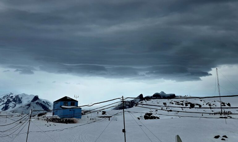
The previous October record was +7.9°C, set in 1968. Meanwhile, Ukrainian scientists recorded the highest temperature in the station’s vicinity in February 2022: +12.7 °C.
“This means that the difference between the all-time maximum and the October maximum is remarkably small — just 1.6°C. However, we must remember that these temperatures were recorded in different seasons. February is the height of the Antarctic summer, while October marks the beginning of spring. This is therefore an alarming trend,” explains Denys Pishniak, Head of the Department of Atmospheric Physics and Geospace at the National Antarctic Scientific Centre (NASC).
In both cases, temperatures rose extremely rapidly. This time, the air temperature rose from +1.2°C to +11.1°C — almost 10 degrees — in just two and a half hours.
At the same time, relative humidity dropped sharply from 90% to 54%, while wind speed increased from 1.5 to 13.1 m/s, and the wind direction changed.
These factors indicate that a foehn wind—a warm, dry wind descending from the mountains —caused the sudden warming.
This phenomenon occurs when a mass of warm, moist air encounters a mountain range and flows over it. In our region, these are the mountains of the Kyiv Peninsula, opposite Galindez Island, where Vernadsky Station is located.
As the air rises, it cools, loses moisture, and forms clouds and precipitation. During condensation, heat is released.
After crossing the mountain ridge, the air descends, compresses, and warms further. This creates a warm, dry airflow that sharply raises temperatures and accelerates glacier melt.
Foehn winds are generally common in our part of Antarctica. However, this particular event was exceptionally intense.
It may have been amplified by another phenomenon — an atmospheric river.
Atmospheric rivers are narrow bands of highly concentrated atmospheric moisture. In recent years, they have increasingly penetrated polar regions from the tropics, transporting large amounts of warm, moist air. This is one of the consequences of climate change that NASC scientists are actively studying.
Interestingly, during the warming event, meteorologists also observed lenticular clouds above the mountains.
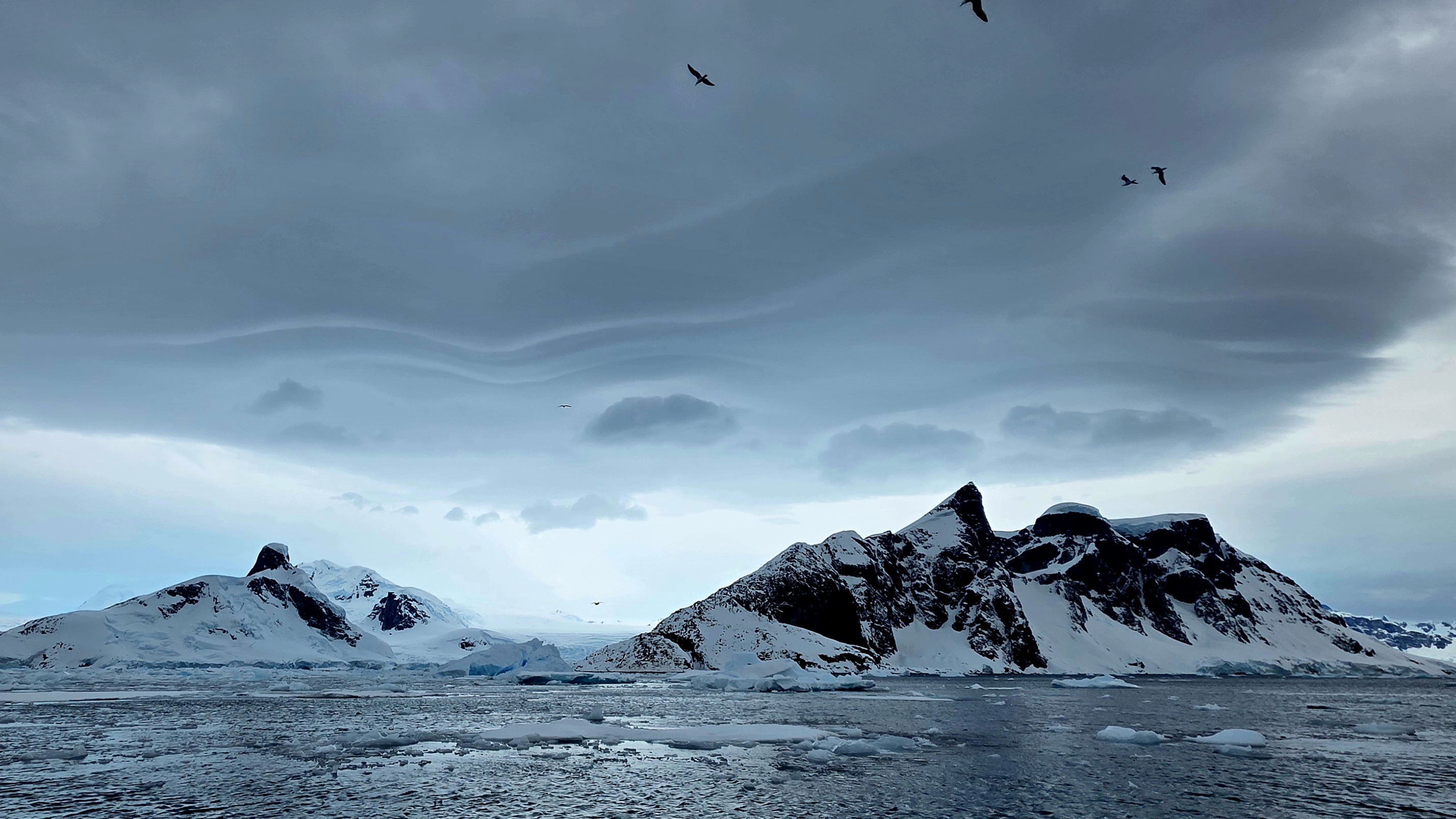
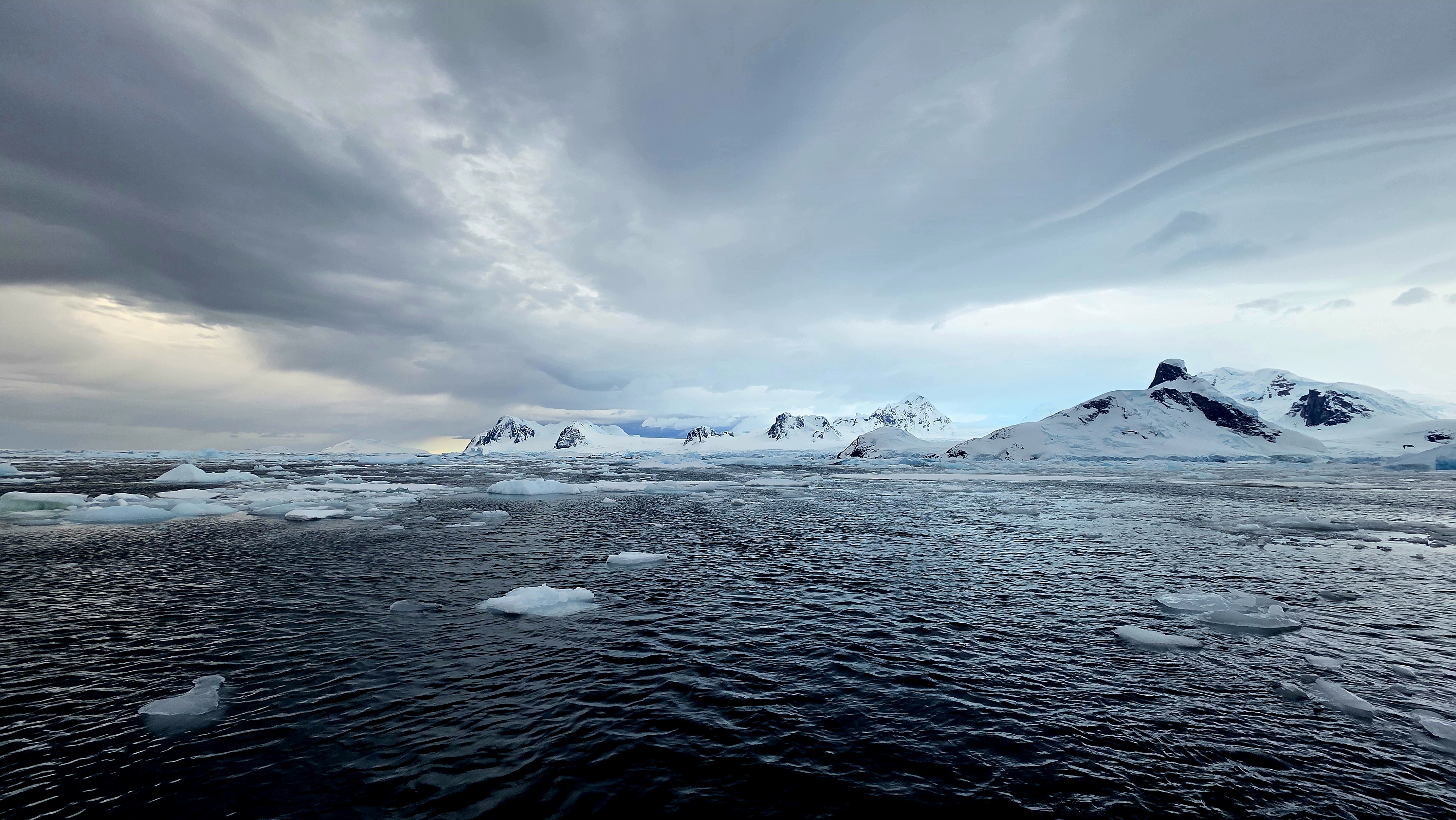
These clouds often accompany foehn winds, forming from moisture that the airflow loses as it crosses the mountain ridge. Because condensation continuously replenishes them, they appear stationary and have a distinctive oval, lens-like shape. You can see them clearly in the photos.
One of the images also shows the source of the extreme warmth — dark clouds above the mountains. They were likely dropping heavy precipitation at that moment.
We thank Denys Pishniak, Anzhelika Hanchuk, and Anastasiia Chyhareva for helping prepare this story.
Photos: Anzhelika Hanchuk