While Russia, which started the war, massively disassembles its icebreakers, Ukraine, even in the conditions of a large-scale war, uses its own icebreaker to create world science.
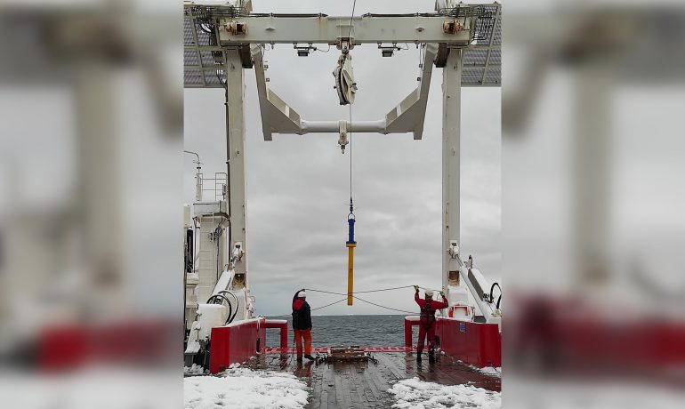
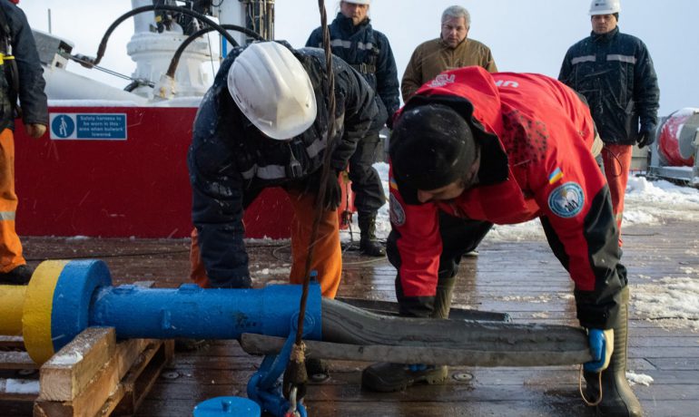
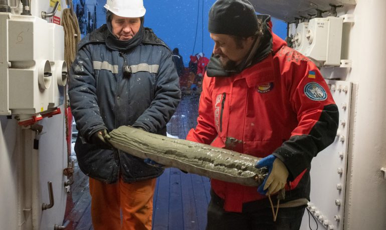
The first results of marine geological research carried out this year on the Ukrainian research icebreaker “Noosfera” have been received.

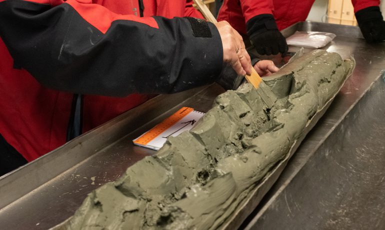
Also, recall that during the first voyage of the vessel to Antarctica, our scientists were able to resume marine geological research that had been interrupted for 20 years.
Then, from aboard the “Noosfera“, scientists took cores of bottom sediments in the Penola Strait, which separates the Argentine Islands archipelago (where “Vernadsky” is located) from the Antarctic Peninsula.
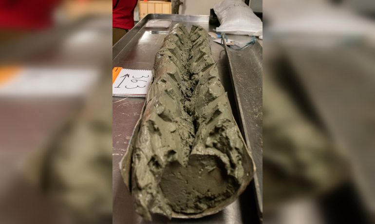
Now we already have the first results of the analysis of these samples. Ukrainian scientists established that with a high degree of probability from 25 to 18 thousand years ago – during the maximum development of the last ice Age – the Argentine archipelago was not separate islands, but a single, rather large island. It had a complex dissected relief and was almost completely covered by a single large glacier. This glacier has formed significant arms and streams which carved characteristic valleys in the crystalline base.
In addition, the level of the Southern Ocean between 15 and 12 thousand years ago was lower than the modern one by 100 and 60 m, respectively. For orientation in the history of the Earth, this is a time of slow decline in the population of megafauna (extinction of the mammoths, etc.) and significant changes in the environment.
About 7,000 years ago, the ocean level rose almost to its current level. The paleovalleys were flooded, only the tops of the single large island remained on the surface of the sea, which is now the Argentine Islands archipelago. The single ice cap was also broken up into separate pieces on some of the largest islands.
Our scientists found these valleys in the underwater relief of the Argentine Islands at depths of 30 to 60 m. They have become almost ideal sedimentary basins (i.e., places where various sedimentary deposits accumulate), because they have a fairly flat bottom and steep and narrow slopes. So bottom sediments were accumulated here quietly, without the threat of being destroyed by icebergs or growlers.
The unique geological record of these deposits contains information about global climate changes over the past 15-12 thousand years. Comparison of selected samples from these valleys and soil cores from the deep-water Penola Strait will allow us to form a paleogeographic and paleoclimatic model of the exit of this region from the last ice Age.
Why is this model important? The coastal transition zone of the Antarctic Peninsula and the Southern Ocean is an important element in understanding the global patterns of climate change. Because, any warming of the climate affects both the coast and the glaciers located there, as well as the temperature of the Southern Ocean. Yes – through understanding the past – this model will help to predict the future of the icy continent.
Thanks for the information to geologist Sergii Kadurin.