This season, our scientists performed another interesting type of research near Vernadsky and from the RV Noosfera. This involves geological research in two directions.
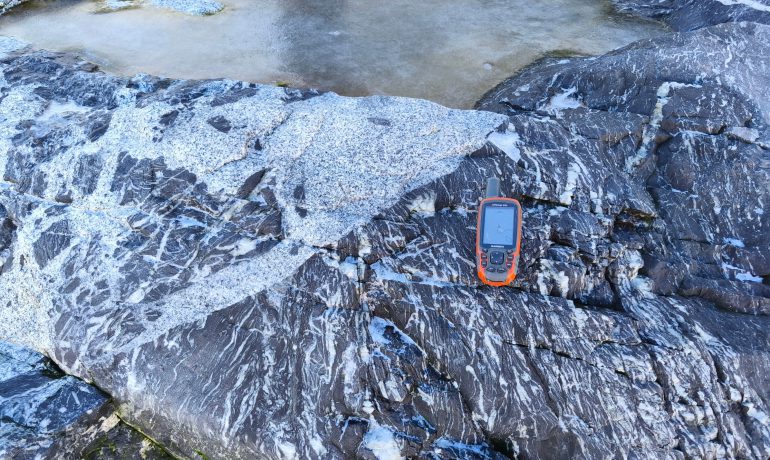
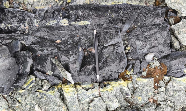
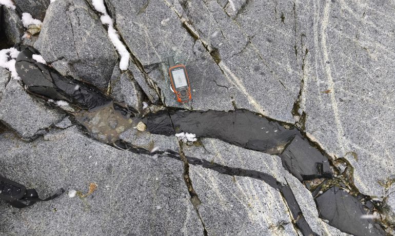
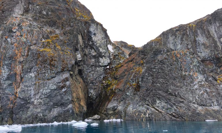
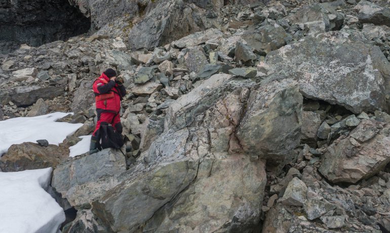
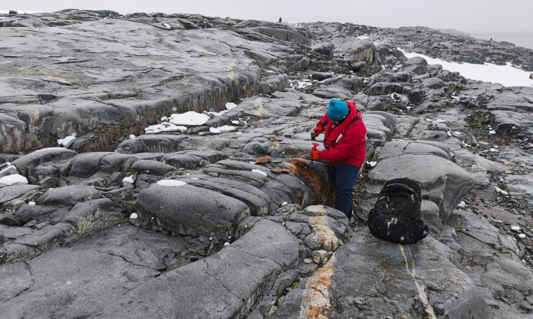
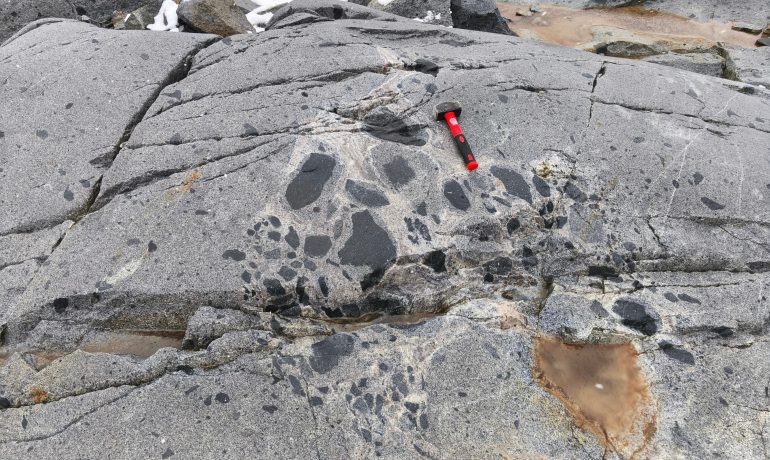
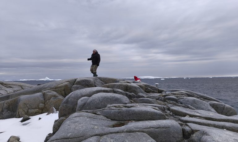
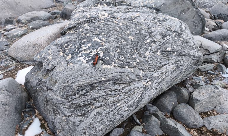
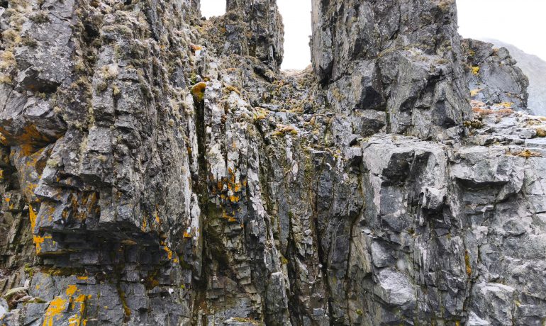
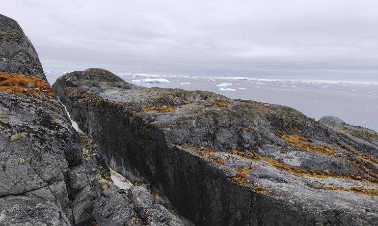
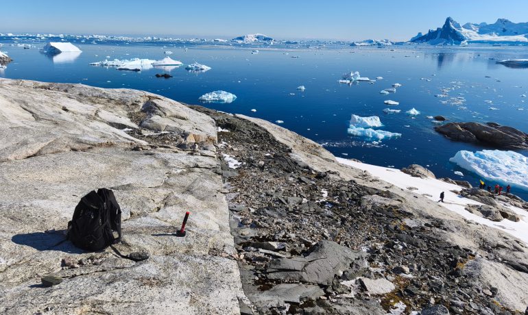
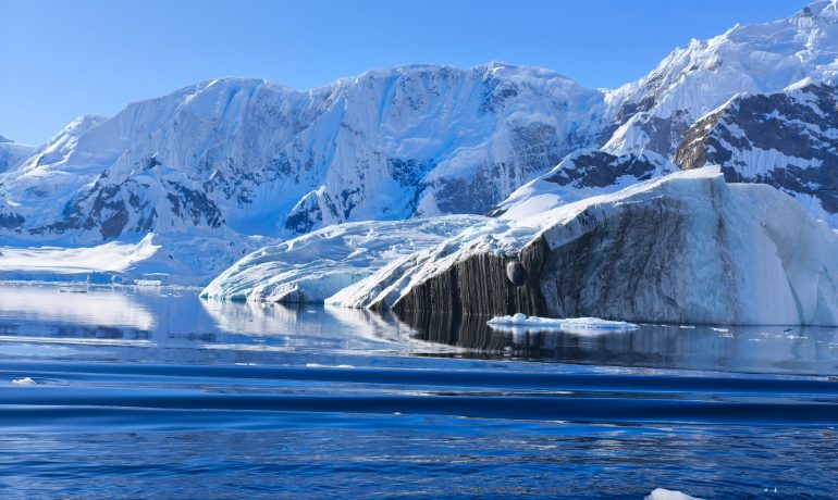
The first one is geological mapping and study of igneous and metamorphic rocks in the area of Vernadsky station (this is the Argentine Islands group and the mainland Kyiv peninsula).
Igneous – those that formed as a result of cooling and solidification of magma (hot molten mass from the Earth’s interior).
Metamorphic – formed as a result of the transformation of sedimentary and igneous rocks under the influence of high pressure, temperature, etc.
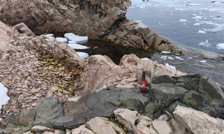
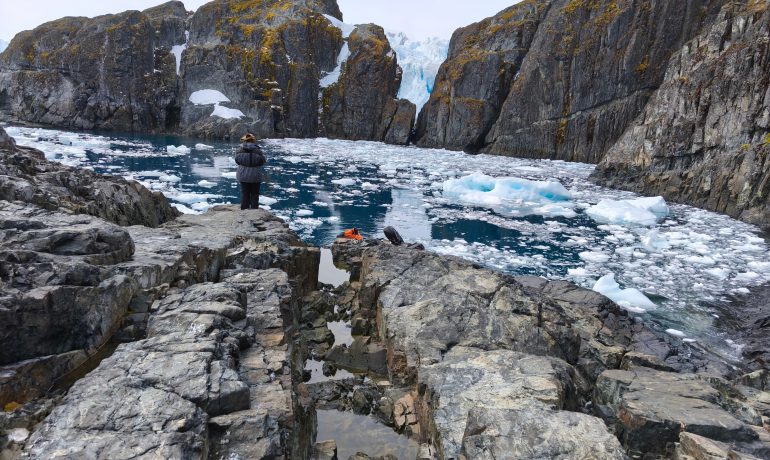
In the designated area, our scientists traveled to the main islands and capes of Kyiv Peninsula. There, they photographed and collected rock samples, described outcrops, and measured bedding elements. A total of 103 samples were collected, which will now be studied in laboratories of Kyiv and Odesa.
The main goals of the research are to better understand the geological and tectonic structure of Vernadsky area and find out the past 100 million years. Scientists also want to analyze the current tectonic and seismic state of the territory and model possible mineral deposits.
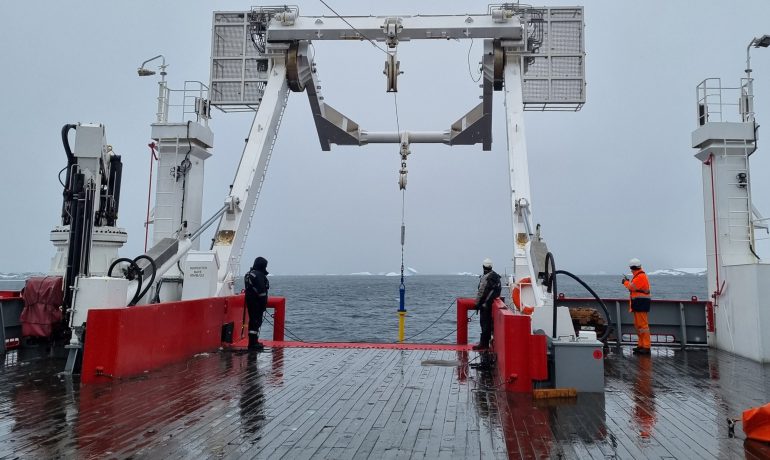
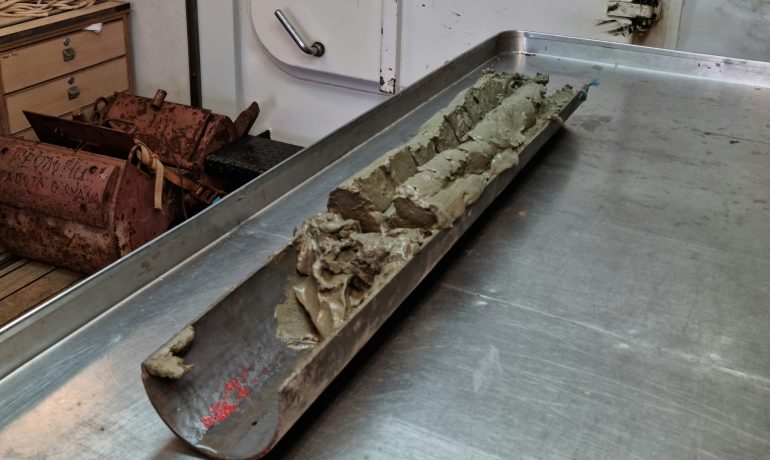
The second direction is the continuation of the study of marine bottom sediments. This season, the third collection of such samples took place using a gravity tube from our RV Noosfera.
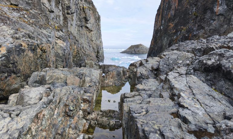
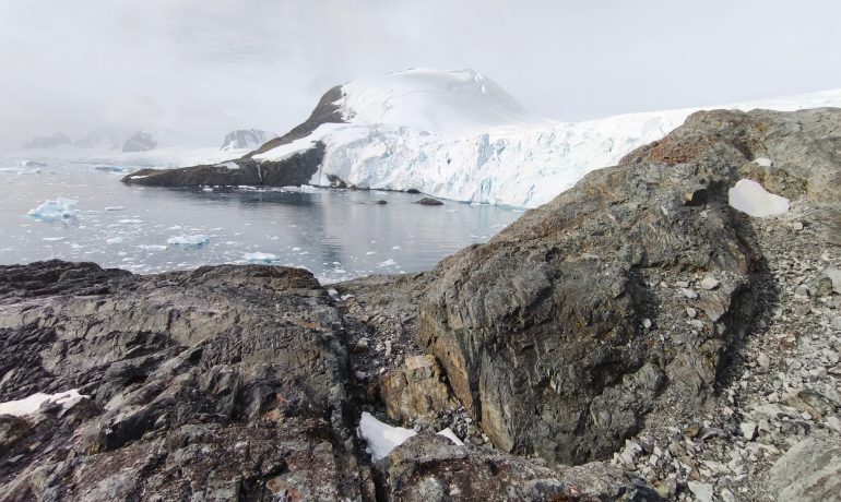
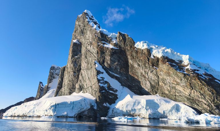
Work continued at new observation points in Penola Strait and French Passage between Argentine Islands and Kyiv Peninsula (i.e. between the archipelago and the continent). The peculiarity of this territory is that different natural processes associated with changes in the ice cover intersect here at the same time.
- On one side, the largest glaciers of Kyiv Peninsula flow into these straits, which discharge a large amount of meltwater, ice, and rock fragments.
- On the other hand, very fast ocean currents form along the straits, which move water masses, icebergs, and growlers. This leads to the rapid development of the organic world.
- In addition, the straits themselves are laid along a large tectonic fault, the activity of which has not yet ended.
All these processes have been occurring within Penola Strait and French Passage since the entire area was released from under the glacier at the end of the last ice age approximately 10-7 thousand years ago. Since then, the entire history of melting glaciers, changes in their position, development of the organic world, geological and ecological phenomena are recorded in the sections of bottom sediments, as in a long-term chronicle – layer by layer.
Therefore, a detailed study of the sections will allow us to decipher the history of development of the mentioned area over the past thousand years as a major ice age recovery process and to separate the role of anthropogenic impact on this process.
Scientists hope to receive the first results by the end of this year, and next year to present them in publications in scientific publications, in particular the Ukrainian Antarctic Journal, as well as at international conferences.
Scientists hope to obtain the first results by the end of this year, and next year to publish them in in scientific journals, in particular, the Ukrainian Antarctic Journal, as well as to present them at international conferences.
Photos and information provided by a participant of a seasonal expedition, geologist Sergii Kadurin.